- Home
-
Advertisements
 Hindoostan Revisited Advertisements
-
Maps
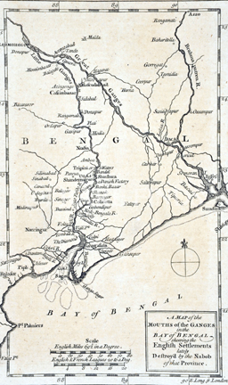
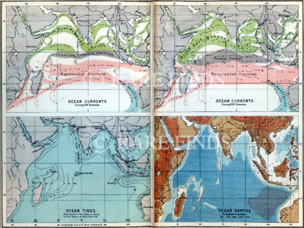
 A selection of old original maps published during the years 1560 - 1930 on British territories in India and Asia, other European powers and their territories in India, independent kingdoms of the Indian empire, the Asian continent, marine areas, town plans and geographical features are available at Rare Finds.
These old maps were created on paper to record/show geographical, political, geological or pictorial images using the print making techniques.
They were usually produced by the master craftsmen who drew, engraved, printed and coloured these maps.
Decorative borders along with illustrations (vignettes) were often added to the maps to make them visually appealing.
-
Original Prints
 Hindoostan Revisited has an extensive selection of old original lithographs, engravings, etchings, aquatints and plate illustrations to choose from.
A majority of these old original lithographs, engravings, etchings, aquatints and plate illustrations were created before the arrival of photography and were published during the period starting from the sixteenth century to the nineteenth century.
The old original lithographs, engravings, etchings, aquatints and plate illustrations are pictorial illustrations which were produced by different print making techniques so that they could be published as more than one piece. The print making techniques were semi mechanical and in the early periods the illustration was produced as a black and white image to which colours were added by hand.
Moreover the mechanical techniques used could only produce a limited number of pieces. Hence these old original lithographs, engravings, etchings, aquatints and plate illustrations are limited edition art works from a very early period.
Their rarity, intrinsic value, artistic value and the unusual subjects makes these old original lithographs, engravings, etchings, aquatints and plate illustrations highly collectable and much coveted decor items.
These old original lithographs, engravings, etchings, aquatints and plate illustrations were produced on a variety of subjects.
Separate sections have been created below to facilitate easy viewing, however as subjects frequently overlap, it is adviseable to go through all sections.
- Arts, Decorative, Architecture
- Caricature, Humour
- Childrens' Illustrations
- Fashion and Costumes
- Historical
- Miscellaneous
- Natural History
- Noteable Artists and Works
- Portraiture, Portraits, Occupations, Trades and Professions, People
- Religious
- Sports and Passtimes
- The Thugs Collection
- Topography Views, City Views, Landscapes
- Views of Old Bombay - Special Series
-
Whats New
 See whats new with Hindoostan Revisited
-
Antiquarian and Rare Books
 Antiquarian and Rare Books


